Showing posts with label family friendly. Show all posts

Monday, January 24, 2022

Local Fun: Bauneg Beg Mountain


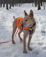
On Saturday (1/23/22), we found a reprieve from the ice by checking out Bauneg Beg Mountain Conservation Area (BB), a Great Works Regional Land Trust property that is comprised of a two-ish mile trail system featuring the three-peaked 866' Bauneg Beg Mountain. 
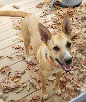
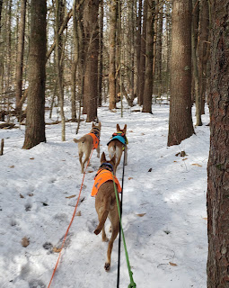
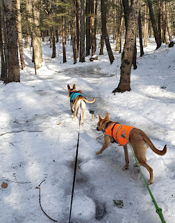
Before jumping in to our report, may I introduce the third member of our pack of blondies - Jinx!! She's the sweetest Mississippi girl, maybe a herder/Malinois mix, who we've been fostering since September and became embedded in our weird little pack faster than she could be adopted out!

So the ladies and I started up the trail around 11:00AM. The small lot (room for 5-6 cars) was full so we tucked in on the side. There are two entrances for BB: the main lot on Fox Farm Hill Road and a pull off with space for about two cars on Bauneg Beg Hill Road. 
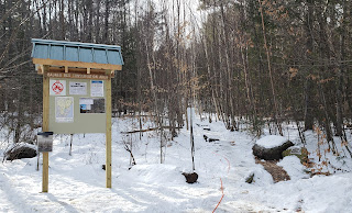
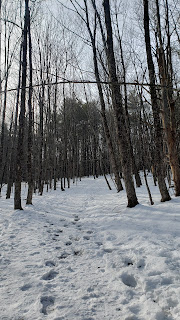
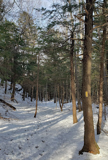
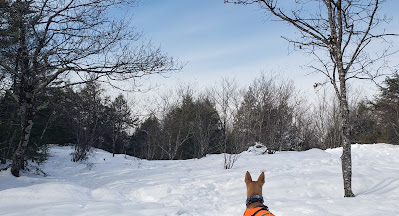
After a short and avoidable section of boiler plate ice at the beginning, the Bauneg Beg Trail hooks left and wanders gently upwards along a wide path through open woods. While less that 25 minutes from home, where all of the trails are covered in ice, I was stoked to learn BB offered perfect packed powder conditions. 
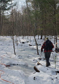
Beginning of Bauneg Beg Trail

Bauneg Beg Trail

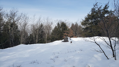
We took the right onto North Peak Loop and reached the summit in just a few minutes after walking through a small pine stand, a stone fence, and into a small clearing with a cairn.
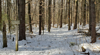


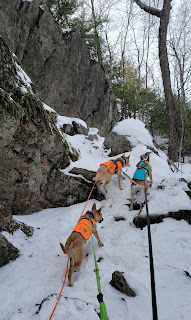
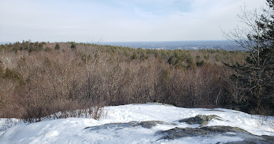
From there, we followed the trail as it zigged and zagged to the next intersection where we kept (slight) right onto Linny's Way and scaled a very short but rocky ascent to Middle Peak. It's a nice spot for a break and limited view. The trail description states the Whites can be seen on a clear day. 
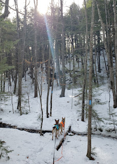
A nice view of where we're heading

Up!

And the top

Just past the lookout is the next intersection, where one can choose to head down Tom's Way towards the secondary entrance or loop back towards the main entrance via Ginny's Way. 

We ran down Tom's for the sake of exploration. It was fun, less travelled, and similar to the other trails in the way it twisted through the woods.
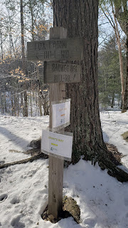


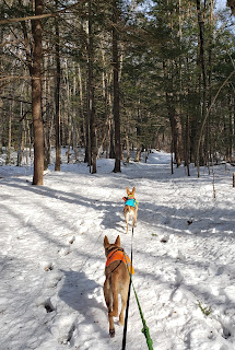
Once we finished backtracking Tom's, we took Ginny's Way down the hill. We hit one giant frozen puddle but it was otherwise smooth sailing.

Ginny's Way after descending Middle Peak

Ice patch ahead

Ginny's Way meeting back up with Bauneg Beg Trail

Overall Impressions

The girls were all about this one! There's only two miles of trails so we covered them all and only ran into two other parties. They may have been the curviest trails I've ever been on; rarely did one go where I expected it to and there were only a few straightaways. All of the trails and junctions were very well marked and the scenery was beautiful, especially around Middle Peak. It was very fun but I'm thinking when the leaves come in on the trees, it might be a little too unpredictable for Miss Reactive; we'll see! For being 25 minutes from home, I'm stoked to have learned there's a nearby trail system other than Blue Job (which we love but is icy and busy) that offers a little hilliness. 

Trail Map


FMI:


Sunday, November 24, 2019

Mt Roberts - Castle in the Clouds


Location: Castle in the Clouds, Ossipee Range, Moultonborough, NH

Elevation, gain: 2570 ft, 1350 ft gain

Trail: In and out via Mt Roberts Tr

Distance: 4.6 mi - 5.5 mi, depending on your source of info*

Difficulty: Moderate

Hike duration: 3 hours, including stops at vistas - easily a good trail running summit or introduction to hiking.

Management agency: Lakes Region Conservation Trust

Parking: Plenty of parking on the Castle in the Clouds property, some lots closer to the trailhead than others.  *This is where I'm guessing the mileage discrepancy comes in.  

Summary:  Mt Roberts is one of my favorite underrated hikes and checks a lot of boxes for us.  The terrain and distance is very Tango-friendly with gentle footing and elevation gains.  But there's plenty of excitement for the wild one within its open hardwood forest, old stone walls, and ledges.  It's closer than the Whites for us but I don't feel cheated out of a "real" hike - there's appreciable elevation gain, solitude from civilization, and beautiful views that we don't have to share with the hoards like on nearby Mt Major.  Worth noting for owners of doggos like my Tybee is that we always hear distant gunshots on this one and there's always moose tracks near the summit.  The Lakes Region Conservation Trust has a kiosk packed with information and a donation box at the first parking lot. 

The trail starts past the horse barn (moved home for the winter but otherwise a welcome site and yes, we've met them on the lower trails).  I believe most of the trail follows an old  carriage road - it's broad, climbs gently, and has excellent footing. 


At about 1 mile is a short spur (was well-marked but the tree has fallen) to  a view out to Winnipesaukee and the Belknap Range.


Then begins the "climb."  The elevation increase comes more steadily and steeper, though still moderate in my opinion for the grade and duration.  Footing remains good, though a little rockier.  On this day, this where I started seeing a few patches of ice. 


One of my absolute favorite parts about Mt Roberts is the amount of time spent on open and partially open ledges, which begins after about another half mile.  For the remainder of the hike, one gradually weaves in and out of the trees, encountering the only evergreens of the hike, and over gentle rock ledges, offering an array of views.


Left: looking up the ridge, right: looking back down from the top.  Note the granite spine of the trail.


In the patches of woods, the ice became more prevalent and there's some hard, crunchy snow that seems to be sticking for the season.  


The trail pops out on the summit loop, you can go either way to reach the summit but I found keeping right easier for orientating myself.  For the descent, we continued on the loop - be sure to keep left and keep an eye out for the Mt Roberts Trail (signage below the actual junction).

Summit:
Is it just me or is she looking directly at Mt Washington?


And that's a wrap! Not much to report about the descent since it's via the same trail, though the views are that much more enjoyable since one is facing them!
Hiking and Fishing                                                                                                                                                                                                                                                                                             

Thursday, July 18, 2019

A Hiker's Ride up the Mt Washington Auto Road


Lately I’ve found myself explaining this one a lot: I’m an avid hiker who prefers to explore on foot but I’m also the proud holder of a Mt Washington Auto Road season pass. I do love being a contradiction...!

Snow in June... that's a contradiction!
Admittedly, I used to roll my eyes at the mention of the Cog or Auto Road - the motorized methods of transportation to the summit of the northeast’s tallest peak. But simple things, like working for a travel agency and watching Tango truck on through lessening body awareness and muscle strength, softened my view and helped me acknowledge what I knew deep down: however one gets to the beloved summit, there is tremendous value in the fact that visitors invest their time and money to get there.

Summit structures
Pulloff shortly below the summit
While, yes, I still go crazy from some of what I see on my way up and at the summit and never make a trip without trying to politely, even lightheartedly, impart a little LNT knowledge, it's a wonderful trip.  And I acknowledge that vehicles allow people who might not otherwise have the means (time, gear, stamina, health, etc.) to access a summit that holds the power to mystify them, wow them with sweeping vistas, and make them more emotionally connected to the landscape.  We, as a society, need that for so many reasons.

View north from the observation deck
Little flowers, big attraction
One of the beautiful views attained by less than a quarter mile 
of descending the aptly nicknamed 'rockpile' (summit cone)


As Tango approaches his 12th birthday, I’m presented with two facts:   

1. I love Mt Washington and the alpine zone. It is my happy place, my Disney World, my heart’s home.

2. Tango’s lower back weakness betrays his otherwise youthful trail smiles. A properly choreographed hip check from a dog friend and he’s in a sit faster than any rally dog… just nowhere near as clean.

So how do I get to continue to share my “happy place” with both my dogs/not exclude Tango because of something that’s beyond his control? Enter a perfectly timed birthday and family that understands that my dogs’ happiness is my happiness - the gift of the Mt Washington Auto Road Pass.

2019 pass #4!
Since our first visit a couple of years ago, the Mt Washington Auto Road has really grown on me.  The itinerary options for a visit are much broader than they seem at first glance. I’ve found the state park (accessible only via the auto road, cog railroad, or on foot) to be a wonderful way to get our non-hiking friends out for a unique experience while challenging Tybee and not being too taxing on Tango.


Although not representative of the hiking experience as a whole, the availability of hot food and “real" bathrooms helped ease our greener companions into hiking and contribute to their positive experience. Moreover, I thought, surely, the appreciation for the work associated with summiting on foot would be lost of our companions. Not so! I made a point of stopping and getting out of the car every 1500 feet or so for us to acclimate to the changing temperature and wind gusts. The drastic change from the valley floor was well understood and the rock hopping off the summit cone isn’t a cake walk, so even the shortest of hikes offered a reasonable challenge for them.

Not a walk in the park!


The classic summit picture is at the cairn in the background.
Usually, there's a line of people waiting their turn.  
Another benefit of the auto road is the ability to combine a visit to my favorite summit with other activities. So far, that’s allowed us to see a whole lot of lupines, kick back at Chocorua Lake on the way home, and more!


Finally, there's something intrinsically satisfying about the chance to enjoy the trails and support the local economy at the same time.  The truth is, I sort of pride myself on finding cheap adventures around this incredible little state, usually away from the crowds.* On the other hand, I also wholly appreciate the value in supporting NH businesses.

The auto road and state park are dog friendly.  Ty loves when I
open up all the windows for the ride, especially the hatch!

Sure, there are concerns like carbon emissions, and yes, if you got there on foot, you should totally get to cut the line at the summit cairn, but I see the auto road & state park as a joint opportunity for regional visitors and residents to connect with what we hikers get to see and experience regularly. The truth is, we need as many advocates as we can get to continue to protect these places as our world changes. 

Our friend taking in Carter-Wildcat Ridge from a pulloff
shortly before the subalpine zone withers into talus

From my perspective, the auto road folks are dedicated advocates for Mt Washington, demonstrated through a number of earnest green initiatives and support of scientific studies.   And they’re always up for a good time, hosting a bunch of niche events to bring out the community, from runners to ATV’ers, and are a part of the Mt Washington Valley community at large. The way these guys tie all that together into a successful business is impressive and all the more endearing to someone who is selective about where she spends her money.

A day visiting George, supporting a local business I respect, engendering a greater appreciation and respect for nature in our friends, and making both puppers happy all at once proves what a great experience the Mt Washington Auto Road can be for anyone from the casually interested to diehard hikers.


*I recommend an early start, visiting towards the shoulders of their open season, or (to some degree - summer is still tourist season) a weekday visit if you and/or your dog prefer a less crowded experience.

Final Note: regardless of how you summit, Mt Washington is no joke.  Check the forecast, prepare for cooler temps, and pack a bag.  One should be prepared for even the smallest of adventures!  Lastly, the cafeteria is cash only, plan accordingly.